
 |
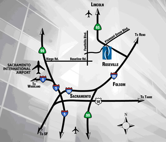
Sacramento International Airport:
1. Leaving Airport merge onto Interstate 5 South toward Sacramento/Yuba City
2. Merge onto Interstate 80 East via Exit 522 toward Reno
3. Merge onto CA-Highway 65 toward Lincoln/Marysville
4. Take the Pleasant Grove Boulevard exit
5. Turn left onto Pleasant Grove Boulevard
6. Turn left onto Highland Pointe Drive
>> Download PDF - Map and Directions
San Francisco International Airport
Estimated Time: 2 Hours / Estimated Distance: 121 Miles
1. Merge onto US-101 North toward San Francisco
2. Keep right to take Interstate 80 East via Exit 433B (toward Bay Bridge/Oakland/Seventh Street/US-101 North [portions toll])
3. Merge onto CA-Highway 65 toward Lincoln/Marysville
4. Take the Pleasant Grove Boulevard exit
5. Turn left onto Pleasant Grove Boulevard
6. Turn left onto Highland Pointe Drive
>> Download PDF - Map and Directions
